Soil Sampling at I3S
In the context of the ClieNFarms project, climate neutral or net-zero farming involves calculating the emissions from farming and offsetting this against carbon sequestered in the soil to arrive at the net carbon emissions of the farm. The only way to reliably measure soil organic carbon is through soil sampling, which involves drilling holes into the soil at 30cm depth and analysing the collected soil in a laboratory to get soil carbon measures.
Measuring and modelling soil carbon stocks and stock changes in agricultural systems is a challenge as soil properties, particularly soil organic carbon (SOC) content, is directly affected by land use (e.g. cropland, grassland, rangeland, or a mixture of all of these) and land management (crop rotation, tillage fertilisation, grazing, mowing …). Likewise, SOC stock can have considerable spatial variation depending on agricultural practices and local pedoclimatic conditions.
Sampling at farm level is an ambitious task as the farm encompasses multiple fields and field managements of heterogeneous nature in terms of the soil environment in space and time. When estimating SOC stock changes it is important to consider the likely variability in space and depth to determine the best sampling design and to achieve detectable difference in soil carbon stocks between two sampling dates.
A sound sampling design stratifies or divides the land into strata where the soil can be assumed to be more or less homogeneous. Soil samples are then collected at multiple points to arrive at a total SOC stock for the field. After a pre-defined interval of a number of years, re-sampling is carried out at the same points to determine change in soil carbon.
New technologies such as satellite-based stratification, AI or machine learning models and modern sampling equipment can ensure higher accuracy of soil carbon and detect smaller changes in the SOC stock.
In the ClieNFarms project, consortium partner Agricircle has defined a soil sampling methodology comprising high resolution soil stratification that combines satellite data and machine learning which is used to identify the most representative sampling points based on soil properties. This method is based on the following steps:
- pre-selection of fields that represent one crop and management area by I3S managers;
- preparation of field boundaries in .shp or .kml formats for selected fields,
- calculation of the sampling strata using the Agricircle portal.
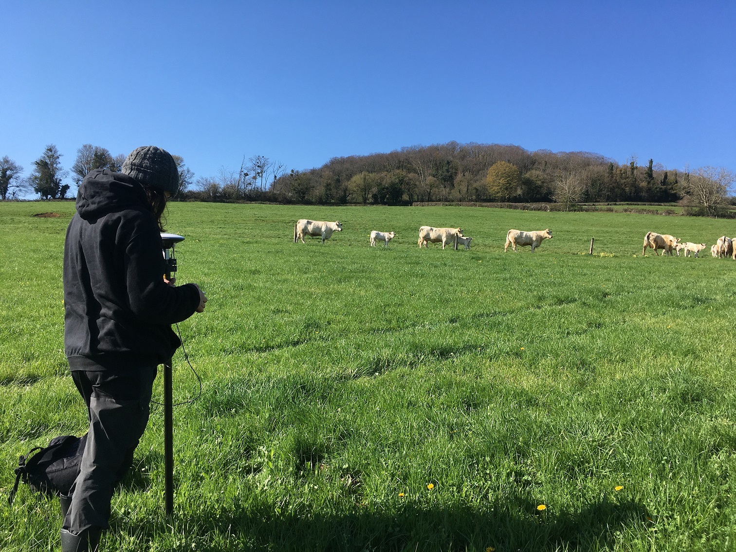
- identification of Precision Sampling Locations which are 10x10m grids where samples are collected.
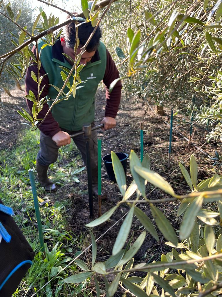
- Soil sampling campaign with sampling of 20 sub-samples at each precision sampling location. Sub samples are pooled per location.
- Sample processing and SOC analyses in a certified laboratory
- Once the results of soil analyses are uploaded back to the AgriCircle portal, the SOC stock for the field are calculated, along with 10x10m soil maps for various soil parameters .
Accurate soil sampling at a granular scale and the ability to detect smaller changes in SOC stocks allow farmers to gain a much deeper understanding of their soils and react quickly to the impact of their practices on the land. Farmers participating in carbon farming schemes are able to demonstrate smaller and more frequent changes to SOC stock, leading to them being compensated fairly and more often for SOC sequestration.